
GPS Navigator with custom maps agro forestry
Application Features:
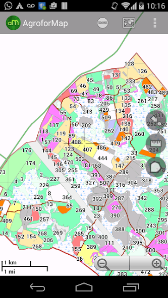
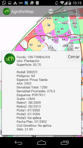
- The data for each field of each planting within reach of a click on the screen;
- Quick consultations on the situation of each plantation: performance, applications, management executed, previous crop, so planting, planting date, soil, etc. (The variables are unique to each client);
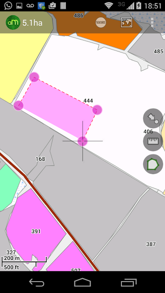
- Function for calculating areas and measures distances;
- Function "My position" that allows the user to accompany the device location;
- Photos, screenshots, multi schemes maps, recording routes;
- Easy and quick handling of the application allows the user to practical experience;
- Enables offline access to all the maps and database clients;
- Without the need for field maps and spreadsheets, application activities and optimizes operator time;
- Your company with much greater speed and agility in agroforestry.
January 21, 2026
January 21, 2026
January 20, 2026
January 20, 2026
January 19, 2026
January 19, 2026
January 19, 2026
January 19, 2026
January 18, 2026
January 18, 2026
 Download APK(15.1MB)